
Categories
Tucson Lifestyle, Local GuidesPublished November 19, 2026
A Local's Guide to Tucson's Best Scenic Drives for Cooler Weather

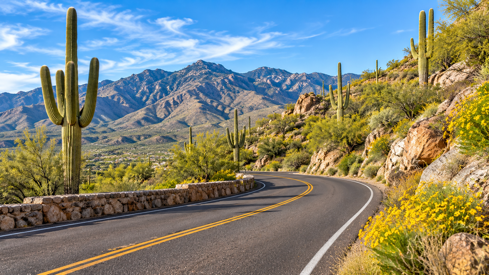
One of the things I appreciate about living in Tucson is how much the scenery can change without traveling very far.
You can start with saguaros and rocky desert hillsides, head into the Santa Catalina Mountains, or drive south toward the open grasslands around Sonoita. Each route offers a different look at Southern Arizona.
And when the weather starts cooling down in the fall, getting out for a drive becomes a wonderful way to spend an afternoon or make a day of it.
You don't necessarily need a big itinerary, either. Sometimes it's enough to pick a route, find a designated place to stop, and enjoy the landscape.
If you're looking for ideas, here are four scenic drives I think are worth getting to know, along with a few practical things to check before you go.
Why Is Cooler Weather a Good Time to Explore Tucson's Scenic Drives?
Fall and winter can offer more comfortable conditions for exploring Tucson's lower-elevation desert roads, although temperatures and weather vary by location and date. Higher-elevation drives, especially Mount Lemmon, may experience colder temperatures, snow, or closures. Travelers should choose routes based on current forecasts, road conditions, daylight, and the type of scenery they want to see.
Tucson's cooler months give us an opportunity to spend more time enjoying the desert landscape without planning every outing around the most intense summer heat.
But there's an important distinction between driving through the Tucson Mountains and heading up Mount Lemmon.
One stays in a desert environment. The other climbs thousands of feet into the Santa Catalina Mountains.
That difference can affect what you wear, what you pack, and whether a particular route is accessible.
The National Weather Service in Tucson provides forecasts and weather alerts that can help you plan around changing conditions.
My suggestion is to think about the scenery you want first, then check the conditions for that particular destination.
What Can You See Along the Mount Lemmon Scenic Byway?
The Mount Lemmon Scenic Byway, also called the Catalina Highway or Sky Island Parkway, climbs from the Sonoran Desert into the Santa Catalina Mountains. Drivers encounter changing vegetation, mountain overlooks, rock formations, and higher-elevation forest. The paved road is generally used year-round, but snow, fire conditions, or other hazards can lead to temporary closures.
If you've lived in Tucson for a while, chances are you've heard someone recommend a drive up Mount Lemmon.
There's a reason it comes up so often.
The scenery changes noticeably as you climb. Lower down, you're surrounded by desert vegetation. Farther up, you begin to see different plants, rock formations, and eventually wooded areas.
According to the U.S. Forest Service's Mount Lemmon and Catalina Highway guide, the scenic route climbs nearly 6,000 feet from the Sonoran Desert toward the mountain's pine forests.
The Forest Service describes a 24-mile scenic route, while the Arizona Department of Transportation's scenic-road listing identifies the broader Sky Island Parkway byway as 27 miles.
Those descriptions use different route extents, so I wouldn't treat either number as an exact distance for every visitor's trip.
What Makes the Drive Interesting?
For me, it's the transition between landscapes.
You can see the mountains from Tucson every day, but driving through them gives you a different perspective.
There are designated pullouts where you can stop and take in the views, along with recreation areas and access to trails.
The Forest Service also identifies Summerhaven and the summit area as destinations along the mountain route.
If you plan to visit a recreation site, check whether a day-use fee or pass applies. The Forest Service recreation guide explains that some sites require fees and that concessionaire-managed locations may have different arrangements.
What About Winter Driving?
This is the route where seasonal planning matters most.
The Catalina Highway has curves, changing elevations, and areas where winter weather can affect driving.
The Forest Service specifically warns that the road may close because of snow or fire danger. Its guide lists 520-351-3351 as a road-conditions hotline.
I would check that information before leaving Tucson, especially after a storm.
And remember that conditions in the valley won't necessarily tell you what's happening higher up.
Alicia's tip: Give yourself time for the overlooks instead of treating Summerhaven as the only destination. The changing scenery along the road is a big part of the experience.
What Makes Gates Pass a Scenic Tucson Drive?
Gates Pass Road crosses the Tucson Mountains west of central Tucson and provides views of rugged desert terrain, saguaros, and surrounding mountain ranges. Gates Pass Overlook is a designated stopping area within Tucson Mountain Park. The road is narrow and winding in places, and access may be affected by weather, construction, or temporary closures.
Gates Pass is a completely different kind of scenic drive from Mount Lemmon.
Instead of climbing into a forest, you're traveling through the rocky terrain of the Tucson Mountains.
The views open up around the pass, and the landscape is full of the shapes and textures that make the Sonoran Desert recognizable.
It's a drive I associate with Tucson's west side: mountains, saguaros, desert slopes, and wide views across the surrounding landscape.
Stop at Gates Pass Overlook
The Pima County Gates Pass Trailhead page identifies the overlook at 6400 West Gates Pass Road.
The county describes a paved staging area with parking and access to the Gates Pass Trail.
For someone who wants to enjoy the scenery without planning a long hike, the overlook is a practical place to stop.
Be sure to use designated parking areas rather than stopping along the roadway for photographs.
Check Road Notices Before You Go
This is particularly important for a guide published in November 2026.
Pima County reported storm damage and repairs on Gates Pass Road during August and September 2026. The county also reports a separate Kinney Road closure from October 1 through November 24, 2026, affecting access near Tucson Mountain Park.
According to the county park's current notices, the Kinney Road work includes a detour and temporary closures affecting some picnic areas and trails.
That doesn't mean every destination in Tucson Mountain Park is closed.
It does mean you should verify your intended route before leaving.
Pima County maintains a road closure and restriction information page for that purpose.
Alicia's tip: Gates Pass works well when you want desert scenery without committing to a mountain ascent. Just remember that the road has curves and limited places to stop, so plan to enjoy the views from designated areas.
How Do You Explore Saguaro National Park's Cactus Forest Loop?
The Cactus Forest Scenic Loop Drive is an eight-mile paved route in Saguaro National Park's Rincon Mountain District, east of Tucson. It passes through saguaro-filled desert scenery with designated overlooks, trailheads, and pullouts. The road includes narrow sections, curves, and hills, and visitors need a valid park entrance pass unless an applicable exception applies.
If your idea of a scenic drive includes lots of saguaros, this is one I'd put on the list.
The Cactus Forest Scenic Loop is in the eastern portion of Saguaro National Park, near the Rincon Mountains.
According to the National Park Service's driving guide, the paved loop is eight miles long and includes scenic vistas, trailheads, and pullouts.
It's a way to experience the park's desert scenery from your vehicle while having opportunities to stop at designated locations.
Why the East District?
Saguaro National Park has two separate districts.
The Rincon Mountain District (East) has the paved Cactus Forest Scenic Loop Drive.
The Tucson Mountain District (West) has the Bajada Loop Drive, which the National Park Service describes as an unpaved, graded dirt route.
That's an important distinction when deciding which drive to take.
The National Park Service's comparison of the driving routes also notes that the east loop is narrow, with tight turns and steep hills.
Plan for Park Access and Fees
Saguaro National Park charges an entrance fee.
As listed on the park's official fees and passes page, the standard private-vehicle entrance fee is $25, valid for seven days and covering both districts. Other pass options and eligibility rules are available.
The park also has restrictions affecting oversized vehicles and certain vehicle-and-trailer combinations on its scenic loop drives.
If you're driving an RV or towing, check those rules before planning your visit.
For current operating information, consult the National Park Service's hours and seasons page.
Alicia's tip: Don't feel like you need to add a hike to make this outing worthwhile. The loop itself offers a chance to slow down and appreciate the cactus forest from designated stopping points.
What Can You Expect on a Scenic Drive Toward Sonoita?
The drive toward Sonoita takes travelers southeast of Tucson into a landscape of rolling grasslands and mountain views. Arizona State Route 83 connects with the Patagonia–Sonoita Scenic Road, which also includes portions of State Route 82. The route offers a different landscape from Tucson's cactus-covered foothills, with conditions that can change during colder months.
If you want to see a different side of Southern Arizona, I'd consider heading toward Sonoita.
The landscape starts to feel noticeably different from the familiar saguaro-covered hillsides around Tucson.
You'll encounter open grasslands, rolling terrain, and views of surrounding mountains.
The Arizona Department of Transportation identifies the Patagonia–Sonoita Scenic Road as a designated 57-mile scenic route using portions of State Routes 82 and 83.
A drive from Tucson toward Sonoita can be part of that larger scenic-road experience.
A Landscape With Its Own Character
What I like about this route is the sense of openness.
Instead of focusing on close-up rock formations or dense cactus stands, you get broader views across grassland valleys.
ADOT's history of State Route 83 describes the region's hilly grasslands and mountain valleys and explains the road's historical role as a transportation corridor.
You can make Sonoita your destination or use it as a starting point for exploring more of the designated scenic route.
If you plan to continue toward Patagonia or visit a recreation area, check the destination's current access and operating information first.
Don't Assume the Weather Matches Tucson
Sonoita's elevation and open terrain can produce conditions that differ from those in Tucson.
During cooler months, check the forecast for Sonoita itself rather than relying only on the temperature at home.
You can use the National Weather Service for weather information and AZ511 for state-highway conditions.
Alicia's tip: Choose this drive when you're in the mood for broad views and a change of landscape. It can also be a good reason to explore Southern Arizona beyond the Tucson metro area.
How Do These Tucson-Area Scenic Drives Compare?
Tucson-area scenic drives offer different landscapes, road characteristics, and planning requirements. Mount Lemmon emphasizes elevation changes and forest scenery, Gates Pass features Tucson Mountain desert views, Cactus Forest Loop offers a paved national park route, and Sonoita provides grassland scenery. The right choice depends on your interests, vehicle, available time, and current conditions.
One of the easiest ways to decide where to go is to think about what kind of scenery you want to see.
These routes aren't interchangeable, and that's what makes them interesting.
Scenic Drive Comparison
| Scenic Drive | Main Landscape | Road Characteristics | What to Check |
|---|---|---|---|
| Mount Lemmon Scenic Byway | Desert foothills, mountain rock formations, higher-elevation forest | Paved mountain highway with curves and elevation changes | Snow or fire-related closures, weather, recreation-site fees |
| Gates Pass Road | Tucson Mountains, saguaros, desert overlooks | Paved, narrow, winding road | County road notices, construction, overlook access |
| Cactus Forest Scenic Loop | Saguaro forest, Rincon Mountain foothills | Eight-mile paved park loop with curves and hills | Entrance pass, park hours, vehicle restrictions |
| Sonoita / SR 83 | Rolling grasslands, valleys, mountain views | State highway through open country | Highway conditions, weather, planned stops |
The route descriptions come from the U.S. Forest Service, Pima County, National Park Service, and Arizona Department of Transportation.
How I'd Choose
For a drive focused on changing elevations and mountain scenery, I'd look at Mount Lemmon.
For a desert overlook and a shorter outing centered on Tucson's west side, I'd consider Gates Pass.
For an established scenic loop with designated stopping points, I'd look at Saguaro National Park East.
And for open grassland scenery beyond Tucson, I'd head toward Sonoita.
None of these choices requires you to see everything in one day.
In fact, I think they're more enjoyable when you leave time to stop and look around.
What Should You Check Before Heading Out?
Before taking a scenic drive near Tucson, check the weather forecast, road closures, destination operating hours, park fees, and vehicle restrictions. Mountain roads may have winter closures, while desert roads can be affected by storms or construction. Carry water, plan for changing temperatures, and use designated parking areas when stopping for views or photographs.
A little preparation can make a big difference, particularly during the transition from fall into winter.
Check the Route, Not Just the Destination
If you're headed to Mount Lemmon, find out whether the highway is open.
If you're visiting Gates Pass, check county road notices and any construction-related detours.
For state highways toward Sonoita, consult AZ511, which provides information about roadwork, restrictions, closures, and weather-related conditions.
For Tucson Mountain Park roads, the Pima County road closure page is a useful resource.
Pack for the Conditions
Even on a drive where you don't plan to hike, I'd bring water, comfortable shoes, and clothing suited to the forecast.
For higher elevations, consider extra layers.
And because scenic roads often include curves, narrow sections, and other road users, keep your attention on driving and use pullouts when you want to enjoy the view.
The Forest Service's Catalina Highway guide specifically reminds drivers to watch for bicyclists and wildlife and to use pullouts for sightseeing.
Confirm the Details Before You Leave
Here's my quick planning checklist:
- Check the weather for the actual destination.
- Verify road access and current closures.
- Confirm park or recreation-site hours.
- Check whether a pass or entrance fee is required.
- Bring water and appropriate clothing.
- Plan stops at designated overlooks and parking areas.
- Leave enough daylight for the route and your return trip.
It's a simple list, but it helps keep the outing focused on the scenery instead of last-minute surprises.
Frequently Asked Questions About Tucson Scenic Drives
People planning scenic drives around Tucson often ask which roads are paved, whether Mount Lemmon is accessible in winter, how national park fees work, and where to see different desert landscapes. The answers vary by route. Official road, weather, and park information should be checked before every trip, particularly after storms or during seasonal closures.
What are some scenic drives near Tucson for cooler weather?
Mount Lemmon Scenic Byway, Gates Pass Road, Saguaro National Park's Cactus Forest Scenic Loop, and the route toward Sonoita offer different Southern Arizona landscapes. Each has its own access considerations and road characteristics.
Is Mount Lemmon open for scenic drives in winter?
The Catalina Highway is generally used year-round, but snow, fire conditions, and other hazards can cause temporary closures. Check the U.S. Forest Service's Mount Lemmon guide and current road information before traveling.
Is the Cactus Forest Scenic Loop paved?
Yes. The eight-mile Cactus Forest Scenic Loop in Saguaro National Park East is paved. The park's Bajada Loop in the west district is unpaved. See the National Park Service driving information.
Do you have to pay to drive through Saguaro National Park?
A valid entrance pass is generally required. The park lists a standard private-vehicle fee of $25, with other passes and eligibility options available. Check the official fees page before visiting.
Is Gates Pass a paved road?
Yes. Gates Pass Road is paved, but it is narrow and winding in places. Use designated overlooks for stopping and check Pima County road updates for current restrictions.
Where can I see grassland scenery near Tucson?
The route toward Sonoita along State Route 83 offers rolling grasslands and mountain views. Portions of SR 83 and SR 82 form the officially designated Patagonia–Sonoita Scenic Road.
Which scenic drive is best if I don't want to hike?
All four can be enjoyed primarily from a vehicle, although the experience varies. The Cactus Forest Scenic Loop and Gates Pass have designated viewing areas, while Mount Lemmon and the Sonoita route offer opportunities to appreciate changing scenery along the drive.
Where should I check road conditions before a scenic drive?
Use AZ511 for Arizona state-highway information, Pima County's road closure updates for county roads, and the U.S. Forest Service for Mount Lemmon recreation and access guidance.
Final Thoughts
One of the reasons I enjoy sharing local Tucson ideas is that there's always another way to see a familiar place.
A drive through Gates Pass feels very different from a trip up Mount Lemmon. The cactus forest east of town has its own character, and the grasslands near Sonoita remind us how varied Southern Arizona really is.
Cooler weather can make it easier to get out and explore, but every route deserves a little planning.
Check the conditions, give yourself time for the scenery, and don't feel like you have to turn every drive into a full-day adventure.
Sometimes a change of view is enough.
And if you're getting to know Tucson or simply looking for something different to do on a weekend, these scenic routes are a wonderful starting point.
Important Note: This guide is for general educational purposes. Weather, road conditions, access restrictions, operating hours, and fees may change. Always verify current information with the relevant government agency before traveling, obey posted signs, and follow local road and park regulations.

Tom Krieger
| The TJK Team - Realty Executives Arizona Territory
or another way