
Categories
Tucson LifestylePublished September 16, 2026
Where to Find Fall Colors Near Tucson

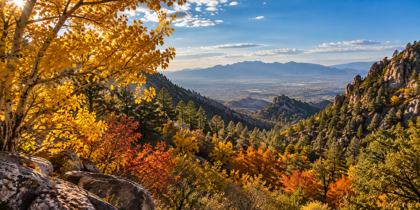
When people picture fall colors, Tucson probably isn't the first place that comes to mind.
Our autumn doesn't usually arrive with entire neighborhoods turning red and gold at the same time. Down in the Sonoran Desert, September and October can still feel surprisingly warm, and saguaros aren't exactly known for putting on a fall foliage show.
But Southern Arizona has something that makes fall much more interesting than you might expect:
Elevation.
Drive into one of our surrounding Sky Island mountain ranges and the landscape can change dramatically. Desert vegetation gives way to oak woodland, riparian canyons, pines, maples, sycamores, and other trees that respond to the changing season differently than plants in the Tucson basin.
That also means there isn't one universal “peak fall color” date for Southern Arizona.
Higher elevations may begin changing while lower canyons are still green. Weather, temperature, moisture, elevation, and individual tree species can all affect what you see.
So rather than trying to predict one perfect weekend, I think the better approach is to know where to look.
Here are several places near Tucson where autumn can look very different from the desert below.
Why Can You Find Fall Colors So Close to Tucson?
Southern Arizona's Sky Islands rise thousands of feet above the surrounding desert, creating cooler environments and different plant communities as elevation increases. That means a drive from Tucson into nearby mountains can take you from Sonoran Desert vegetation into oak woodland, riparian areas, pine forests, and places where deciduous trees produce noticeable seasonal color.
This is one of my favorite things about Southern Arizona geography.
You can leave a landscape filled with saguaros, palo verdes, and mesquite and gradually move into a completely different environment without leaving the region.
The Sky Island effect is especially clear in southeastern Arizona, where mountain ranges rise above surrounding desert and grassland.
At Chiricahua National Monument, for example, the National Park Service explains that changing elevations support a mixture of grasslands, deciduous and evergreen forests, scrublands, and desert plant communities.
That elevation change also affects temperature.
The result is that fall doesn't happen everywhere at the same time.
If Tucson still feels like summer, the mountains may already be moving toward autumn.
Mount Lemmon and the Santa Catalina Mountains
Mount Lemmon is the most convenient high-elevation fall excursion from Tucson, with the Catalina Highway climbing from desert surroundings into much cooler mountain environments. Different elevations support different vegetation, so fall color can appear in pockets rather than all at once. Visitors should expect changing weather and check current Forest Service and road conditions before traveling.
If I wanted to look for fall color without turning it into an all-day road trip, Mount Lemmon would be the obvious place to start.
The drive itself is part of the experience.
As you climb the Catalina Highway, the landscape changes repeatedly.
And that's really the theme of fall color in Southern Arizona:
Don't expect one giant wall of color. Look for pockets of it.
Depending on elevation, location, and current conditions, you may see changing deciduous trees mixed among evergreens and mountain vegetation.
Some years are more colorful than others.
Some weekends are better than others.
And one part of the mountain can look completely different from another.
That's why I wouldn't tell someone, “Go on this exact weekend and you'll see peak color.”
Southern Arizona doesn't work quite that neatly.
Instead, I would treat the drive as an opportunity to explore several elevations.
Stop at designated overlooks and recreation areas.
Take a short hike if conditions and your experience level make that appropriate.
And keep looking as you climb.
Where Should You Look for Fall Color on Mount Lemmon?
Fall color on Mount Lemmon is best approached as an elevation-based experience rather than a single destination. Look for deciduous trees in drainage areas, sheltered slopes, and mixed woodland as you travel higher into the Santa Catalina Mountains. Exact color varies by year, so current Forest Service conditions are more useful than relying on a fixed annual peak date.
This is where I would resist the temptation to create a “secret spot” list.
Mountain conditions change.
Roads and recreation areas can close.
Fire, storms, maintenance, and seasonal conditions can affect access.
And some of the prettiest areas may require hiking rather than simply pulling off the road.
A better strategy is to use official Forest Service recreation information and choose established public areas appropriate for your plans.
The Coronado National Forest manages recreation areas throughout the Santa Catalina Mountains and provides current information about trails, closures, roads, fees, and restrictions.
If you're going specifically for fall color, give yourself time.
The best view may not be at the summit.
Sometimes it's a small stand of changing trees along a drainage or a patch of yellow tucked into a canyon below you.
That's part of the fun.
Madera Canyon and the Santa Rita Mountains
Madera Canyon offers a wooded canyon environment less than an hour from Tucson, with elevations beginning around 5,000 feet and vegetation that includes oak and sycamore communities. Its paved scenic road, creekside recreation areas, and network of hiking trails make it a practical destination for people who want to combine seasonal scenery with a Southern Arizona day trip.
Madera Canyon feels different from Tucson almost immediately.
It's tucked into the Santa Rita Mountains south of the city, and the Coronado National Forest describes it as a wooded canyon at approximately 5,000 feet with a paved road, creekside picnic areas, and numerous hiking trails.
Forest Service resource information identifies oaks and sycamores among the important tree species in Madera Canyon.
That combination of canyon shade, elevation, and deciduous vegetation is what makes it interesting in fall.
Madera also works well for people who want options.
You don't necessarily have to commit to a major mountain hike.
You can enjoy the scenic drive and developed recreation areas, or choose from trails of different lengths and difficulty levels.
The Forest Service identifies Madera Canyon as a year-round recreation destination, although visitors should still check current weather, closures, and restrictions.
Day-use areas also require a fee.
Ramsey Canyon Preserve
Ramsey Canyon Preserve near Sierra Vista offers one of southeastern Arizona's distinctive riparian canyon environments. A spring-fed stream, high canyon walls, and a northeast-facing setting support moisture-loving plants including sycamores and maples alongside desert vegetation. Fall days are typically cooler, making the preserve an appealing destination for seasonal scenery and hiking.
Ramsey Canyon is farther from Tucson, but it's a fascinating example of how much the landscape can change in southeastern Arizona.
The preserve is managed by The Nature Conservancy and sits about 90 miles southeast of Tucson, near Sierra Vista.
What makes the canyon unusual is its environment.
A spring-fed stream, high canyon walls, and its orientation create cooler, moister conditions than you might expect in this part of Arizona.
The Nature Conservancy identifies sycamores and maples among the water-loving plants growing along Ramsey Creek, sometimes within only a few feet of cacti, yucca, and agaves.
That combination is very Southern Arizona.
You can have plants associated with a cool riparian canyon growing remarkably close to vegetation that looks unmistakably desert.
The preserve describes fall days as cool and bright, with temperatures averaging about 10–15 degrees cooler than Tucson.
If you're looking for an actual walk through a canyon environment rather than primarily a scenic drive, Ramsey Canyon deserves consideration.
What Should You Know Before Visiting Ramsey Canyon?
Ramsey Canyon Preserve has more controlled access than a national forest recreation area. The preserve is closed Tuesdays and Wednesdays, has seasonal operating hours, charges an entrance fee, and has limited first-come parking. Pets are prohibited except for service animals. Visitors should check current Nature Conservancy information before making the drive from Tucson.
This is one destination where planning ahead really matters.
As of September 2026, The Nature Conservancy lists the preserve as:
- Closed Tuesdays and Wednesdays
- Open 8 a.m. to 5 p.m. from March 1 through October 31
- Open 9 a.m. to 4 p.m. from November 1 through February 28
There is an admission fee, and parking is limited to 27 spaces on a first-come, first-served basis.
There is no parking along the road below the preserve.
Pets are also prohibited, although service animals are permitted.
Those details matter because Ramsey Canyon isn't the kind of place where I would recommend driving 90 miles and assuming you'll figure everything out when you arrive.
Check before you leave.
Chiricahua National Monument
Chiricahua National Monument is a longer trip from Tucson, but its Sky Island setting combines dramatic rock formations with grassland, woodland, deciduous trees, and evergreen forest. Arizona sycamores are among the deciduous species that change color in fall, while elevation differences create varying temperatures and vegetation throughout the monument.
Chiricahua National Monument is the option I'd choose when the fall-color trip is really an excuse for a bigger Southern Arizona adventure.
The landscape is famous for its rhyolite rock formations, but the vegetation deserves attention too.
The National Park Service specifically notes that Arizona sycamores in the monument are deciduous and their leaves change colors in the fall.
The park's vegetation includes grasslands, deciduous and evergreen forests, scrublands, and desert communities. National Park Service
And the scenery changes with elevation.
According to the National Park Service, elevations range from about 5,124 feet at the park entrance to 7,310 feet on Sugarloaf Mountain.
Higher parts of the monument can be cooler and windier than the entrance area.
That makes layers a good idea, especially later in fall.
And if you need proof that autumn color really does show up here, the National Park Service's official Chiricahua photo collection even includes imagery identified as fall colors along Bonita Canyon. NPS Photo Gallery
The Chiricahua Mountains Beyond the Monument
The broader Chiricahua Mountains contain additional high-elevation forest and riparian environments, including areas with Rocky Mountain maples that the Forest Service specifically identifies for autumn color. These destinations can be considerably more remote than Chiricahua National Monument, with rough forest roads, limited services, and seasonal access considerations that make advance planning important.
If you're an experienced hiker and want to go farther, the Coronado National Forest contains some very specific fall-color opportunities in the Chiricahua Mountains.
One official example is the Mormon Canyon Trail.
The U.S. Forest Service describes a riparian section of Mormon Canyon containing Rocky Mountain maples and specifically notes autumn as a time to enjoy the fall colors.
But this is not the same kind of trip as driving up Mount Lemmon.
The trail area is around 9,240 feet in elevation.
Forest roads can be rough and dusty, and the Forest Service warns that they may become muddy and slick when wet.
Potable water and restrooms are not available at the trailhead.
This is exactly why I separate “beautiful place to see fall color” from “easy fall day trip.”
They're not always the same thing.
Which Fall-Color Destination Is Right for You?
The right fall-color destination depends on how far you want to travel and whether you prefer a scenic drive, developed recreation area, nature preserve, or longer mountain hike. Mount Lemmon offers the closest high-elevation option, while Madera and Ramsey Canyons emphasize wooded canyon environments and Chiricahua provides a longer Sky Island excursion.
| Destination | Setting | Fall-Color Experience | Trip Style |
|---|---|---|---|
| Mount Lemmon | Santa Catalina Mountains | Pockets of deciduous color across changing elevations | Scenic drive + optional hiking |
| Madera Canyon | Santa Rita Mountains | Oak, sycamore, and wooded canyon scenery | Scenic drive + hiking |
| Ramsey Canyon Preserve | Huachuca Mountains | Sycamore, maple, and riparian vegetation | Walking + nature preserve |
| Chiricahua National Monument | Chiricahua Mountains | Sycamores, woodland, mountain scenery, and rock formations | Longer day trip + hiking |
| Mormon Canyon / Chiricahua NF | High-elevation Chiricahua Mountains | Rocky Mountain maples in a riparian setting | More remote hiking |
If you want the easiest option from Tucson, Mount Lemmon is the natural starting point.
If you want a wooded canyon without going as far as Sierra Vista, consider Madera Canyon.
If you want a more focused nature-preserve experience, Ramsey Canyon offers something different.
And if you want fall color as part of a bigger southeastern Arizona day trip, Chiricahua National Monument is hard to overlook.
When Do Fall Colors Usually Appear Near Tucson?
Fall color in Southern Arizona doesn't follow one reliable regional peak date because elevation, tree species, temperature, moisture, and annual weather conditions vary considerably. Higher-elevation areas can change earlier than lower canyons, while some deciduous species hold color later. October into November is generally the period when travelers begin watching mountain and canyon conditions most closely.
I know this is the question everyone really wants answered:
When should I go?
And I wish there were one perfect weekend I could give you.
There isn't.
Southern Arizona has too many elevation changes and too many different plant communities for that.
A high mountain area can be changing while a lower canyon is still mostly green.
Then wind or cold weather can shorten the display in one place while another area is just beginning.
That's why I would be cautious with social-media posts declaring:
“Peak color is this weekend!”
That may be true for the exact location where someone took the picture.
It doesn't mean the entire mountain range looks the same.
Think in terms of a fall-color season, not a single fall-color day.
Why Does Elevation Affect Fall Color?
Elevation changes temperature, exposure, moisture, and the types of plants that can grow in Southern Arizona's mountains. Higher locations are generally cooler than the desert below and can support plant communities not found in central Tucson. Because those environments differ, seasonal changes can begin at different times even within the same mountain range.
You can see this clearly at Chiricahua National Monument.
The National Park Service notes that it can be warm near the visitor center at roughly 5,400 feet while conditions at Massai Point, around 6,800 feet, are cooler and breezier.
That same concept applies across Southern Arizona's Sky Islands.
Elevation isn't just about temperature.
It helps shape the entire plant community.
That's why a fall trip near Tucson can sometimes feel like traveling much farther than the mileage suggests.
Where Can You See Fall Color Without a Long Hike?
Mount Lemmon and Madera Canyon are among the more practical choices for experiencing changing mountain vegetation without committing to a long backcountry hike. Both offer paved driving routes and developed recreation areas, although the amount and location of visible fall color vary. Designated overlooks, picnic areas, and short trails can provide additional viewing opportunities.
Not everyone wants to hike several miles to find autumn.
And you don't have to.
Mount Lemmon's biggest advantage is the Catalina Highway itself.
You're moving through changing elevations while staying on a paved mountain road.
Madera Canyon also has a paved scenic road. The Forest Service identifies creekside picnic areas and multiple hiking opportunities along the canyon.
That makes both destinations easier to customize.
You can make the outing primarily a scenic drive.
Or you can add a walk or hike based on your interests, ability, weather, and current conditions.
Just use designated parking and recreation areas rather than stopping somewhere unsafe because a particular tree happens to look good.
What Should You Bring on a Fall-Color Trip?
Mountain and canyon conditions near Tucson can be significantly cooler than temperatures in the city, especially at higher elevations and later in the season. Useful preparation includes layered clothing, water, sturdy footwear for hiking, downloaded directions, and current weather and road information. Remote Forest Service destinations may have few or no visitor services.
This is where Tucson weather can trick you.
You leave home and it's warm.
Then you drive several thousand feet higher.
Suddenly the jacket you almost left behind becomes your favorite possession.
For most fall outings, I would think about:
- Water
- Clothing layers
- Appropriate walking or hiking shoes
- Sun protection
- Downloaded maps or directions
- A charged phone
- Current weather information
For more remote Forest Service destinations, don't assume you'll have water, restrooms, or reliable cell service.
The Forest Service's Mormon Canyon information, for example, lists no potable water and no restrooms at that site. Coronado National Forest
The farther you get from developed recreation areas, the more planning matters.
Check Conditions Before You Leave Tucson
Fall mountain conditions can change because of weather, wildfire activity, road closures, maintenance, snow, or other restrictions. Before leaving Tucson, check the managing agency's current information for the specific destination. Forest Service motor-vehicle maps, National Park Service alerts, preserve hours, and weather forecasts are more reliable than an older travel article or social-media post.
This is probably the most important practical advice in the guide.
Check before you go.
The Forest Service recommends checking land-management agencies for current restrictions and area closures before outdoor recreation. Coronado National Forest
For Forest Service roads, official Motor Vehicle Use Maps identify which routes are legally open to motorized travel and any applicable seasonal restrictions. U.S. Forest Service
For Chiricahua, use current National Park Service alerts and visitor information.
For Ramsey Canyon, check The Nature Conservancy.
And for Mount Lemmon and Madera Canyon, check current Coronado National Forest information.
A beautiful photo from last October can tell you what a place looked like then.
It can't tell you whether the road is open today.
Frequently Asked Questions About Fall Colors Near Tucson
Where is the closest place to Tucson to see fall colors?
Mount Lemmon and the Santa Catalina Mountains are generally the most convenient high-elevation option from Tucson. The amount and location of fall color vary by elevation and annual conditions.
When do fall colors peak on Mount Lemmon?
There isn't a reliable single peak date every year. Different elevations and tree species can change at different times, and weather conditions affect how long color lasts. October into the broader autumn season is a useful period to watch current mountain conditions.
Does Tucson itself get fall colors?
Some deciduous landscaping and native riparian vegetation in the Tucson area can show seasonal changes, but the broader fall-color experience is generally more noticeable in Southern Arizona's higher-elevation mountain and canyon environments.
Where can I see fall colors without hiking?
Mount Lemmon's Catalina Highway and the paved road through Madera Canyon provide scenic-driving opportunities. Fall color varies, so there is no guarantee that every section of either drive will be colorful at the same time.
Is Madera Canyon open year-round?
The Forest Service identifies Madera Canyon as a year-round recreation destination. Current weather, closures, restrictions, and road conditions should still be checked before visiting.
Are dogs allowed at Ramsey Canyon Preserve?
Pets are prohibited at Ramsey Canyon Preserve. Service animals are permitted according to The Nature Conservancy's current visitor information.
Does Ramsey Canyon charge an entrance fee?
Yes. The Nature Conservancy currently lists an entrance fee for Ramsey Canyon Preserve. Fees and policies can change, so verify current information before visiting.
Does Chiricahua National Monument have fall colors?
Yes. The National Park Service identifies Arizona sycamores as deciduous trees whose leaves change color in fall, and the park's official photo collection includes fall color along Bonita Canyon.
Why do the mountains change color before lower areas?
Higher elevations generally experience cooler conditions and support different plant communities than the desert below. Those differences can cause seasonal changes to occur at different times.
What is the best weekend for fall colors near Tucson?
There is no single weekend that can reliably be called the best every year. Conditions vary by elevation, location, species, and weather. Checking current information shortly before your trip is more useful than relying on a fixed annual date.
Final Thoughts
Fall in Tucson doesn't look like fall in New England.
And I think that's part of what makes it interesting.
You can start the day surrounded by saguaros and end up walking beneath sycamores, maples, oaks, and pines.
You can watch the landscape change as the road climbs.
And instead of one enormous wave of autumn color, you start noticing smaller details:
A yellow tree tucked into a canyon.
A patch of red along a creek.
Golden leaves against dark evergreens.
A changing sycamore framed by the rock formations at Chiricahua.
That's Southern Arizona fall.
It's less about finding one perfect “peak foliage” weekend and more about understanding how elevation and landscape create little pockets of autumn throughout the region.
And sometimes the drive to find them is just as interesting as the color itself.
Visitor Information Note
Fall color, weather, road conditions, closures, recreation fees, operating hours, fire restrictions, parking availability, and trail conditions can change. Before traveling, verify current information directly with the Coronado National Forest, National Park Service, The Nature Conservancy, or the agency responsible for the destination you plan to visit.

Tom Krieger
| The TJK Team - Realty Executives Arizona Territory
or another way